Grade 12 GIS Skills | Geography Tasks (EN) — 2024
Schools (Grades 8–12)

This course provides four stand-alone extension GIS lessons covering the entire Grade 12 Geography curriculum. These lessons focus on topics like climate, geomorphology, economic geography, and settlement patterns. Each lesson includes an instructional video, notes, GIS data, and a marking guide that teachers can use for SBA task submissions. After completing and submitting a minimum of two tasks, students are eligible for a GIS license. It is recommended that the GIS and Remote Sensing course be completed first.

Delivery: Asynchronous

Grade 10 Map Skills | Mapping Tectonic Plates, Earthquakes and Volcanoes (EN) — 2024
Schools (Grades 8–12)

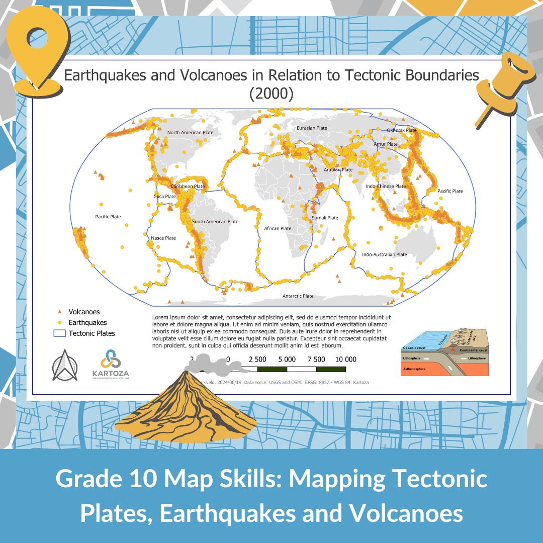
This course offers Grade 10 learners materials aligned with their curriculum, focusing on the introduction of GIS concepts. The tasks are designed to enhance understanding in key study areas.

Tasks:

  • World Map (Raster Data Format)
  • Tectonic Plates, Earthquakes, and Volcanoes (Vector Data Format)

Delivery: Asynchronous

Grade 8 Map Skills | Provinces of South Africa (EN) — 2024
Schools (Grades 8–12)

This course provides Grade 8 learners with access to materials aligned with their current curriculum. The resources include a printable puzzle and a task designed using QGIS to introduce students to map creation, specifically focusing on creating a map of South Africa.

Task: Provinces of South Africa Map

Delivery: Asynchronous

GDSC | General Participation Certificate (EN) — 2024
Schools (Grades 8–12)

The General Participation Certificate is the training and instruction component of the certificate task.

Training and instructions for the certificate task includes the following:

  • Using a geospatial software (GIS) package
  • Data management and organising data files to be shared with the group collaboratively
  • Using different types of data
  • Using geoprocessing tools to perform spatial operations
  • Performing spatial queries using the attribute tables of data layers
  • Understanding map projections to produce georeferenced maps

Delivery: Asynchronous with technical support

GDSC | Advanced Certificate (EN) — 2024
Schools (Grades 8–12)

Welcome to the Advanced Certificate Program! This course evaluates your knowledge and skills based on the General Participation Certificate course. The following criteria assess the groups:

  • Inquiry and Research Skills: This program will enhance your research skills, enabling you to explore complex topics and gain in-depth knowledge.
  • Critical Thinking and Application: Develop critical thinking skills and solve complex problems through analysis and evaluation of real-world scenarios.
  • Analysis and Problem Solving: The program focuses on improving analytical skills for creative problem-solving and effective solution-providing.
  • Collaboration: "Collaboration is key in our curriculum. You'll work with peers on projects and assignments, fostering teamwork and communication skills."

By successfully completing this program, you will not only receive the Advanced Certificate but also gain valuable skills that are highly relevant in today's competitive world. Get ready to embark on a rewarding educational journey that will empower you to excel in various fields.